Monday, July 1, 2013

Colorado Trail, Coming Home for a bit, Day 7


Day 7--June 27, 2013

We packed up as usual, but more casually, as we were only hiking a few feet to the road.  Where the CT crosses Jefferson Lake Road we put down our packs and ate peanut butter and jelly on whole wheat bagels.  We waited for Rob to come.  As we waited a bicyclist came through and told us about some of his adventures on the CT.  He waited for his partner.  We got cell service about the time they left, and Rob arrived a short time later.  It was great to see Rob.  We had lots to share.

Once in the vehicle we discussed how to recover the VUE.  We drove over Boreas Pass through Breckenridge to Copper Mountain. 
We ate at a Mexican restaurant next door to the Silver Dollar Saloon.

The Mexican restaurant is across the street from the famed Tabor Opera House.


We had lunch in Leadville, and then Rob took us to Camp Hale to get the VUE. 

If we had followed the original plan, Rob and I would have hiked down the valley behind us and driven the VUE home on Friday.
The CT behind us in Segment 8 where the VUE was parked.
Sarah and I drove home through Minturn in the VUE and arrived at my house around 3:30 pm.  It was very hot in Denver!!!

Colorado Trail, Segment 6, Day 6


Day 6--June 26, 2013

We ate breakfast burritos and got on the trail the earliest time yet--9:23!  Before starting we saw some bikers leave the campground on the CT.  As we hiked we saw a mom, her son, and her mother out for a stroll.  We hiked through beautiful forest until we came to a clearing with a bench.  Now we had beautiful views of South Park and ranch houses below.  As we hiked we planned the bubbly party for Fall Kick Off. 


Two bikers approached us as we came to a great vantage point.  They asked if we were tame.  We said we were friendly, and they said they were vicious.  They took our picture with the great views behind us, and we took their pictures too. 
The two bicyclists took great pictures of us with South Park behind us.

Jefferson Lake in the mountains behind us was our goal for the day.
We stopped at Guernsey Creek for a snack.  This was supposed to be our campsite on Day 3.  The peace and quiet was interrupted by ATVs and dirt bikes.  We also saw two backpackers.  Along the trail we found we had cell service, and we learned that Rob's flight would be late so he would not be able to hike tomorrow.  We texted that we still wanted him to pick us up.  I also texted Kathryn. 
The sign at Deadman Creek
At Deadman's Creek, we knew we had only about a mile and half left so we played in the stream.  We had a snack and met a man named Eric from Ohio who was thru-hiking.  He was doing about 25 miles per day and had a bit of news about the fire.  We also saw two older gentlemen getting water from the stream.

We climbed and passed through a dead forest that reminded us of ruins.  We saw all the bikers return, and then we descended to Jefferson Lake Road.  We crossed the road knowing it was the end of our hike. 

This sign would help Rob find us on Thursday morning.
We are halfway between Kenosha Pass and Georgia Pass.
We put down our packs and headed to Jefferson Creek to fetch water.   
We followed this sign for one tenth of mile to get water out of Jefferson Creek. 
We camped a few feet from this sign.
We set up our camp between the trail and a picnic ground so we could use a table and the bathrooms. 
Before dinner we planned the Bubbly Party and recorded our thoughts.  We had stroganoff and chili for dinner.  We turned in early due to the mosquitoes from the beaver ponds and hoped Rob would come for us in the morning.

Colorado Trail, Segment 5, Day 5


Day 5--June 25, 2013

We slept until 8:00 am--no middle of the night evacuation.  We had grits for breakfast.  Sarah could not believe I had never had grits before.  It was a little windy and hard to take down the tent.  We packed up and headed to the water to fill up before starting our daily trek. 
Johnson Gulch Sign with my poles and pack
This is where we were hanging out when we met Jim and his grandsons.
We filtered water for our climb.  They did too.

As we filtered the water, we met Jim, Carl, Ben and another of Jim's grandsons.  Jim is thru-hiking, and for these segments, he is accompanied by his three grandsons.   He has someone to hike with for the entire CT except the last three segments.

As they used their Steripen to filter their water, we had a great conversation.  We learned a little bit more about the fire.  These four camped beside the fire trucks the previous night.  We learned that Jim was a middle school science teacher.  As we chatted, two bikers came through on their way to Rock Creek.


From Will's Campsite on the way to Kenosha Pass
We got on the trail kind of late, around 11:00 am.  We climbed and soon got cell service and checked in with folks in Denver.  Further on we met a man training for a 95-mile hike in Scotland.  He had some information about the fire and told us about rescuing one of the Chinese girls that got separated from her friend.  He took her to the REI in Lakewood so she could get her pole fixed.  She spent the night at his house, and he returned her to the trail.


After chatting with the guy going to Scotland and checking out the vistas 
As we chatted with this man, the kids from DC Oaks reappeared.  Yesterday their group had been separated by the fire.  The boys made it to the Long Gulch Trailhead where they were shuttled back to the Rock Creek Trailhead, but the girls did not.  The male teacher had to call the principal to explain that the group was not complete.  He hoped that the girls had turned around and hiked back to their camp.  Eventually they were all reunited at Rock Creek.  However now they had to change their plans and were all hiking back to Kenosha Pass and would return to Castle Rock the next day.

Check out the vistas in the background
We continued our climb to some beautiful vistas of the Ten Mile Range (we think!).

From above we saw several Forest Service roads leading into Jefferson.

We saw the bikers again and spoke to the man that was going to Scotland again.  We also got another view of the fire from afar. 

A view of the fire one day later--still smokin'!
We saw two more bikers both coming and going.  Near the summit we called Kathryn after some texts and also called Rob to explain the change in plans for Thursday.  As we were talking to Kathryn three bikers were struggling up the trail.  We have been curious about how bikers handle some of the tough terrain.
  
One of our first views of South Park
Upon our descent we saw some great views of Jefferson and South Park.   
Another early view of South Park
As we approached Kenosha Pass not only could we hear highway 285 but we saw a group of college aged kids near a bench that was dedicated to a 17 year old. 

We saw several of these teepees built with fallen wood on both sides of Kenosha Pass.  This was the first one we saw.  We wondered who built them.  Boy Scouts?
We proceeded to Kenosha  Pass and read signs on the east side of the pass.  We learned that there is a campground on both sides of the pass.  The campground on the east side costs $15 per night, and the one on the west side costs $18 per night. 

We crossed highway 285 and proceeded along the trail after "signing in."  We met a woman coming down a dirt road that crossed the CT.  Her name was Annie, and she invited us into the campground later.  We hiked a few more feet and found a place to camp.  We set up our tent and ate dinner.  Then we took our water bottles into the campground to meet Annie and her friend Elise.  We visited for about 45 minutes or so and learned that they are both teachers.  Annie's husband was the art teacher at Lakewood High School four years ago.  Annie is retired.  Elise teaches English to Mexican students at Longmont High School.  We filled our water bottles and used the bathroom before we returned to our tent.  Annie and Elise walked by our campsite before retiring for the evening.


Colorado Trail, Segment 5, Day 4


Day 4--June 24, 2013

We ate breakfast burritos and had a beautiful hike downhill. 

We encountered our only snow as we tried to cross this stream.  We checked out many options but determined the best option was simply to walk across the snow.  It felt stable and did not crunch.  There was snow upstream and downstream.
Along the way we met three boys and their teacher from DC Oaks--an alternative school in Castle Rock (Woody, Cash, and Quentin).  All were in good spirits and happy to be out hiking.  About an hour and a half later, we met three girls, their teacher, and her daughter, also from DC Oaks.  They were not having as good a time as the boys.  There were lots of complaints and some whining.  They had camped the previous evening at Kenosha and hiked on Sunday to Rock Creek Trailhead.  They camped there last night and were now hiking to Long Gulch Trailhead.  They would be shuttled back to Rock Creek to camp tonight.  Then tomorrow they would start again at Long Gulch and hike to the Lost Creek Campground which we saw at Brookside McCurdy.  These were the only people we saw this day on the trail--probably because it was Monday.


We were having a great day with great weather and a beautiful hike! 

The trail approaching Rock Creek
Views at the beginning of Segment 5


We got cell service at the Rock Creek Trailhead.  We checked in.  I texted Rob about changing our plans and going past Kenosha Pass to Jefferson Lake.  I also texted Kathryn about our progress.

We saw this rock on top of another rock with tape underneath.
Along the trail we found a note taped to a rock with a rock on top.  The note was written in Chinese.  Sarah told me what she knew about this situation from Facebook.  Apparently two Chinese girls were hiking and got separated.  We got a picture of the note and the rocks.  We also started taking pictures of the wild flowers we saw.
Here is the note written under the rock.  Notice the message written in Chinese.

A trail marker after we crossed Rock Creek
Our goal was to camp at Johnson Gulch at mile 8.4 so we could make the climb into Kenosha Pass fresh in the morning.  This is the last water spot until Kenosha.  As we approached we saw a tent on the top of the hill and could see someone inside. 
Our campsite on night #4.  Beyond the trees in the background was Will's tent before he moved on one mile further.

We set up our tent in the lower meadow to give him space.  We didn't have a lot of privacy, but it was adequate.  We washed my hair, and we washed our socks.  We wrote in our journals. 
Sarah hanging out at our campsite late afternoon.

Looking at our campsite from on the hill near Will's campsite.
This was Sarah's favorite campsite of our trip.
A view of the fire from Will's campsite.  We had camped the night before where this fire was burning now.

On one of Sarah's trips to get water, the man camped at the top of the hill, Will, came down for water as well.  He really came down to tell Sarah that he could see a fire in the distance.  He explained that he planned to pack up his camp and move a mile or more further down the trail to get out of a three mile radius that could be evacuated due to the fire.
We estimated that the fire was about 5 miles away. Plus we had Rock Creek, a fairly large water source, beween us and the fire.  We were only .4 miles from the Rock Creek Trailhead if we needed to evacuate.
We had chicken and dumplings for dinner with a different preparation than the other backpacking meals.  Yum!  We washed dishes for the first time.  After dinner we hiked up to Will's campsite to see the fire.  We took pictures of the smoke and discussed our options.  We decided we were pretty safe.


Our campsite looking down from Will's campsite.  Sarah's favorite spot!
We played cards in the tent.  As I went to sleep I wondered if we would be awakened in the middle of the night by a ranger evacuating us.
To the right of the tent you can see the rocks and fire ring where we hung out.  When we arrived we had salami sandwiches and then started cleaning up a bit to feel better.  We had no trees to hang bags so they eventually ended up sitting in a small tree for each bag.

Colorado Trail, Segments 4 & 5, Day 3


Day 3--June 23, 2013


We had a light breakfast and left camp around 9:45 am.  Beautiful hiking!  We saw the great campsites that had been our goal the previous day. 


Sarah points out a CT confidence marker on the gate at the end of Long Gulch. We wanted to camp in this area.

A view from the outcrops where we called Rob and the Averys
At around mile 14.6 near some rock outcrops, we got cell service and called Rob to see if he would meet us at the end of the segment so we could off load our excess food.  He could not, so we called the Averys.  They agreed.  As we were communicating, we met a man who was thru-hiking from Illinois.  We talked about his food and his plan.  The hike down was great!
We saw this sign and continued along the Colorado Trail.  Sarah stopped me a bit later and said we needed to go back because we needed to take another short trail to the trailhead to meet Chris and Kathryn.  There was a sign that said "Long Gulch Trailhead."  So thru-hikers actually would never see the trailhead because this sign has them continue over the bridge.  Kind of confusing!

We got to Long Gulch Trailhead with a bit of confusion.  We actually passed it and had to backtrack. 


Long Gulch where we had lunch with Chris and Kathryn
Once there, we sorted through our food and decided what to keep and what to send home.  We also sent home some equipment that we didn't need.  We ate lunch with Chris and Kathryn, and when they departed we packed up to begin Segment 5.

We entered the Lost Creek Wilderness again.  When we started in Segment 4 we were in the Lost Creek Wilderness.  We left it on Saturday morning at mile 8.2.  Now we re-entered it on Sunday afternoon.  No bikes!  YEA!!!
Segment 5 started with a climb, but not as bad as Segment 4.  Along the way we smelled smoke and tried to do some research on Channel 9.  We also tried to reach out via text or phone.

We got to our chosen destination at mile 2.9 near a stream.  We set up camp in a great location because it was flat! 

Views from our campsite toward the stream
Our campsite on night #3


As we were setting up the tent, we saw a mother and daughter hiking with another man about 7:00 pm.  They were trying to get to the Rock Creek Trailhead to camp.  We got in the tent due to the mosquitoes and played cards.  Then it rained and thundered.  There was lots of lightening.  Wonderful!  We slept 12 hours!  This was probably my favorite campsite of our trip, minus the mosquitoes.


Colorado Trail, Segment 4, Day 2


Day 2--June 22, 2013

We got up around 8:00 am and started packing and breaking down our camp.  We had peanut butter and jelly on whole wheat bagels for breakfast--quick and easy.  I was very surprised I had no appetite.  We left camp around 10:00 am and hiked downhill.  Beautiful! 

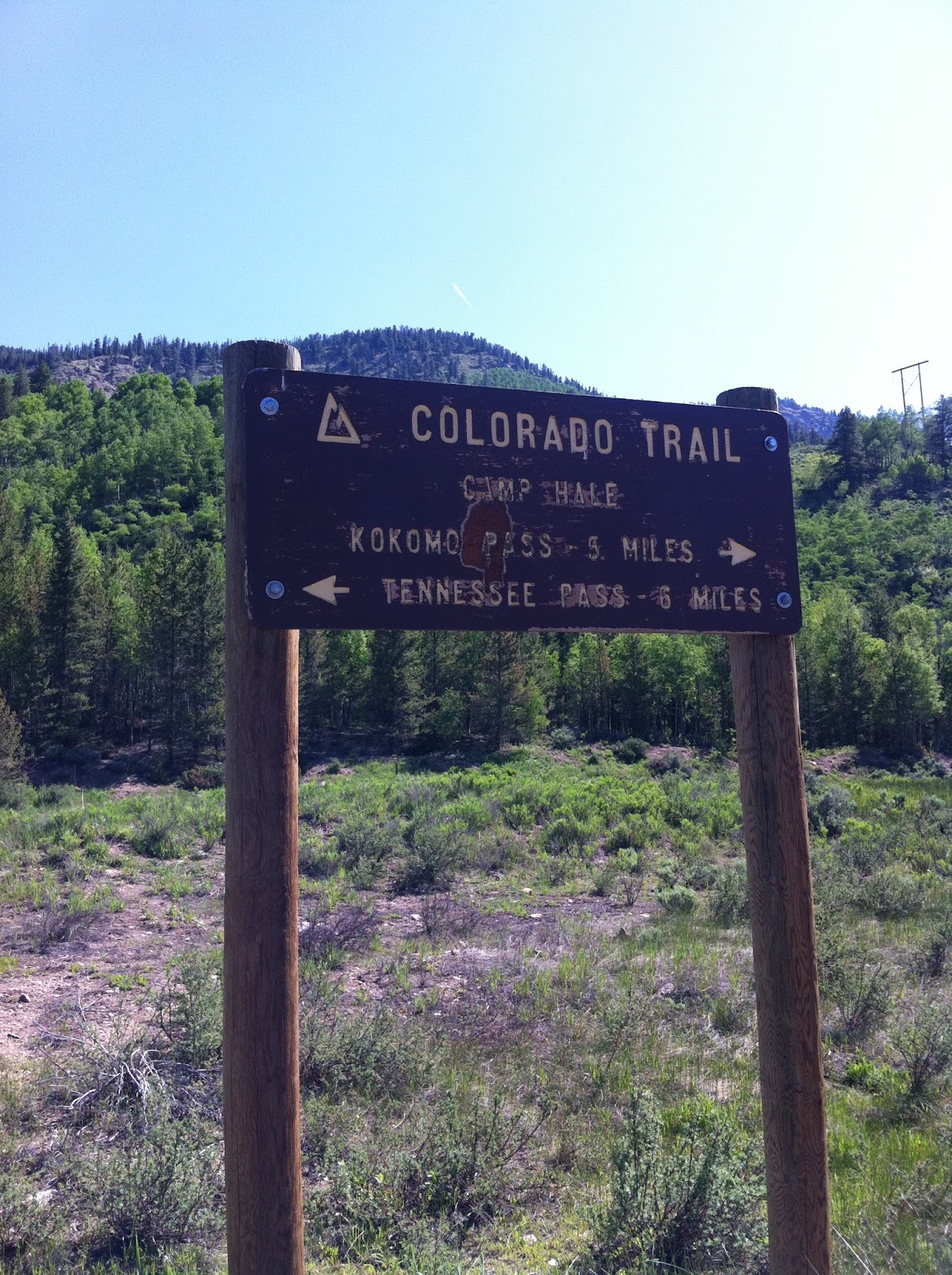
When we crossed the wilderness boundary at mile 8.2, we were very confused.  We saw no water, and the data book said there should be some.  This is where the two guys from the evening before were headed.  Bear Chaser said she planned to camp here too.  There was no place to put a tent due to the steep slope, and there was no water.  What did we miss?

An hour or so after breaking camp, we arrived at Brookside McCurdy--where we had planned to camp the previous evening.  What a beautiful spot!  We need to come back here to camp later in the summer!  We filtered water and refilled our water bottles and took care of our personal needs.  As we arrived we saw a man and his son as they approached us from behind.  The man was definitely in a hurry and didn't take the time to chat with us.  As we rested, we saw two other couples set off on day hikes and saw two men with backpacks head toward the campground for lunch in the shade.

We started through Long Gulch--it is true to its name...LONG!  This section was long, hot, and hard to use our poles because the trail was very narrow.  After about 45 minutes we met three friendly people:  Wobbles like a Weeble, Clomps like a Dinosaur, and Breathes like a Porn Star.  They were very friendly and wanted to chat with us.  As we left them, the fourth in their party arrived...Brett.  He was suffering from leg cramps like I had the previous day.  Sarah and I discussed later where this group planned to camp.  They, too, were headed for mile 8.2 and the wilderness boundary where we saw no water and no campsite.  We regretted not sharing our discovery with them.

After a couple of hours we stopped for lunch in the shade of a tree.  We saw a guy training with a day pack.  We saw a couple of bicyclists twice (going both directions).  After lunch we saw the guy that was training return.  He was doing the entire section as a day hike in preparation for thru-hiking the CT later this summer.  He had hiked a big trail in Minnesota last year.

Our campsite on night #2.  We sat on a log to make our meals, put on our boots, etc.
We wanted to camp at about mile 14.5 where the data book said there were great campsites, but we didn't quite make it.  I would guess we probably stopped at about mile 13.5 and dry camped.  We stopped around 6:00 pm.  I washed my socks and laid down for a nap.  Sarah made dinner--Chicken Enchiladas, played solitaire, and wrote in her journal.  We were both asleep before 9:00 pm.  We were tired!

Colorado Trail, Segment 4, Day 1

Day 1--June 21, 2013

For the last several months we have prepared for this day.  We have planned and shopped and organized.  Yesterday, Rob and I drove through Minturn to park the VUE at Camp Hale so we would have wheels to come back on Friday evening. 
The CT sign where we parked the VUE.

Rob stands at the CT sign for where we will end our hike on Friday.
The plan was that Sarah and I would hike Segments 4, 5, 6, and 7.  Rob would meet us in Copper Mountain on Thursday morning and he and I would continue into Segment 8.  Sarah would drive home in the AURA.

We agreed to meet at 7:00 am to finish packing.  Rob would take us to the trailhead of Segment 4 due to fires in Segment 2.  We had so much stuff that after our packs were full, we had to eliminate items.  Stuff was strewn about the living room as decisions were made.  Finally we headed to the car with breakfast burritos in hand.  A picture was taken and posted on Facebook. 

All packed up, ready to hit the trail.

We were trail bound! Left the trailhead south of Bailey around 11:00 am.  Rob took pictures. 

At the trailhead of Segment 4 outside of Bailey
Just about ready to start hiking!
 We saw a woman at the trailhead covered from head to toe with a large pack.  We tried to interact with her to no avail.  Later we met her as she was resting.  We learned her trail name was Bear Chaser because of an encounter she had on the Appalachian Trail.  She has lots of hiking experience and lives in Arizona.  We expected to see her again as she said she planned to camp at the North Fork of Lost Creek at mile 8.2.  Our plans were to camp at Brookside McCurdy at mile 8.9.
Later in the day we met Early Bird, Starbuck, and Map Man.   These three have lots of experience on the Colorado Trail (CT).  They were doing Segment 4 this weekend and planned to do the segment near Lake City in early July.  We thought we might see them later as they, too, planned to camp at Brookside McCurdy that evening.
 
Walking through one of many aspen forests
 

This section starts at 8280 feet.  We camped at about 10,400 feet.  That means we climbed about 2120 feet.  Whew!  We were a bit naive!  Early in our hike we climbed about 900 feet and stopped for a snack.  Then we climbed about 500 feet of a very rocky jeep road.  Strenuous!  The data book informed us that we would leave that road and turn left for a trail that climbed another 600 feet.  On this trail we met two guys that were trying to get to the North Fork of Lost Creek where they planned to camp for the evening.
We camped near a small stream because it was getting late (after 7:30 pm) and we were very tired because we each had only about four hours of sleep the night before.  We debated pushing on to get to the North Fork of Lost Creek like the others, however we decided we needed to stop.  We put up our tent on a slope and slid throughout the night until we found ourselves against some small trees.  Sarah had Thai Chicken for dinner; I had carrots and hummus.  We did have cell service so Sarah sent some texts to say we were OK.